Dix Mountain - 8/4/2018
I first hiked this mountain way back in August
of 2002 with Brendan on our first overnight trip together. We
summited from the same direction then as well. I now remember why I
have always said it's one of the steepest and most rugged peaks I've
climbed.
This trip would prove to be a memorable adventure for a few reasons. To start, I was accompanying Brian on his final peak to complete his 46er quest. Brian has joined me on a good many hikes, especially early in both of our hiking careers. We were also joined this day by Matt who is a friend of Brian's who had already achieved his 46er status in 2016.
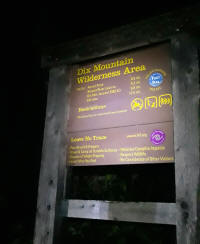
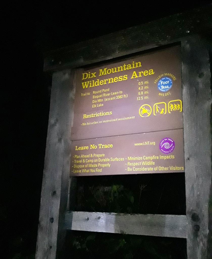
We met at the Round Pond trailhead around 8:30 and were on our way by 8:45. There was no urgency to start early, the days are still long right? The weather was very nice to start, while it was fairly warm and muggy, there were surprisingly very few bugs and no rain (yet).
It wouldn't be long before we had skirted around Round Pond and were well on our way to the junction with the Noonmark trail. We were passed by a group of probably 10 or more young hikers going to Noonmark. We would pass them taking a break at the junction prior to heading toward the summit.
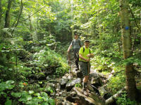
Shortly after here, it began to rain but we were sheltered by the canopy so we only felt enough water to give us a break from the heat, it was actually quite welcoming. It didn't last however. The trail is fairly wide and easy to travel on with few exceptions such as large boulders.
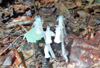
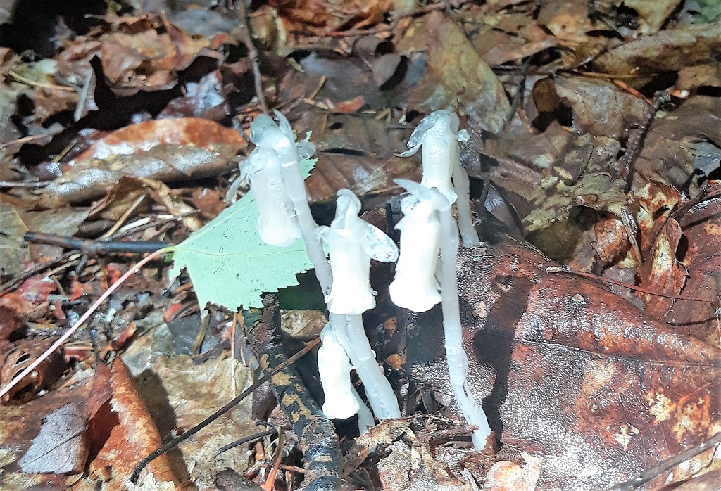
We noticed some interesting flora growing under the canopy in the wet leaves. I believe these are called Indian Pipe Fungus, it's actually not a true fungus however. Google it!
Once again we saw some of these interesting patterns on rocks, I've seen them many times before in the "dacks, not sure if it's moss or some sort of fossil.
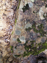 Check out the one we saw last fall near Lake Tear of the Clouds -
here
Check out the one we saw last fall near Lake Tear of the Clouds -
here
Of course we saw many toads and a few salamanders as well. I took many pictures of the trail and surrounding nature as well as my hiking partners along the way. Of course none of them exist anymore, we'll get to that. I'm glad Brian and Matt took some pics on the trip.
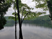
The trail follows the Bouquet River for quite a while. It's always been very enjoyable to me to hike alongside a creek or brook, both from a visual perspective and just to hear the running water. There are many nice clear pools and small waterfalls along the way as well.
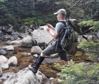 Here I am taking some pictures of just such a clear pool.
We arrived at the old lean-to site in time for lunch. We would also fill up on water here in the Bouquet. From here the trail starts to get moderately steep, but the real work would begin once we arrived at the base of the large slide. Just prior to the slide, the trail is literally right in the creek bed.
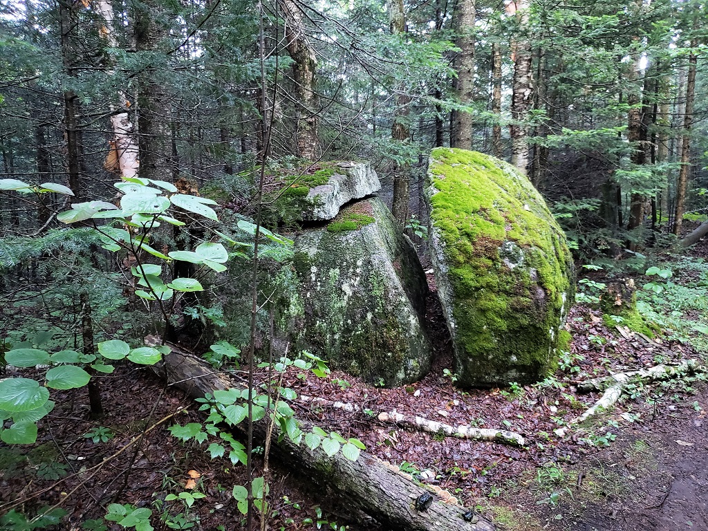
 A very interesting boulder that looks like it was split with a
cleaver.
A very interesting boulder that looks like it was split with a
cleaver.
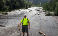
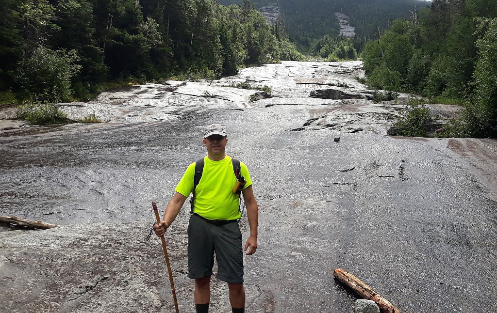
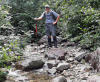 Standing in the trail / creek just prior to entering the clearing at
the base of the slide.
Standing in the trail / creek just prior to entering the clearing at
the base of the slide.
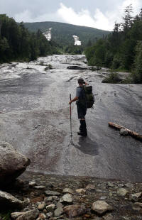
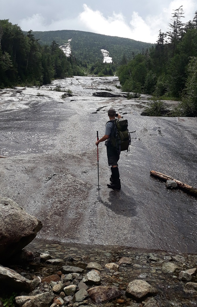
 Here's Matt entering the clearing and about to be amazed at what's
before him.
Here's Matt entering the clearing and about to be amazed at what's
before him.
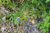
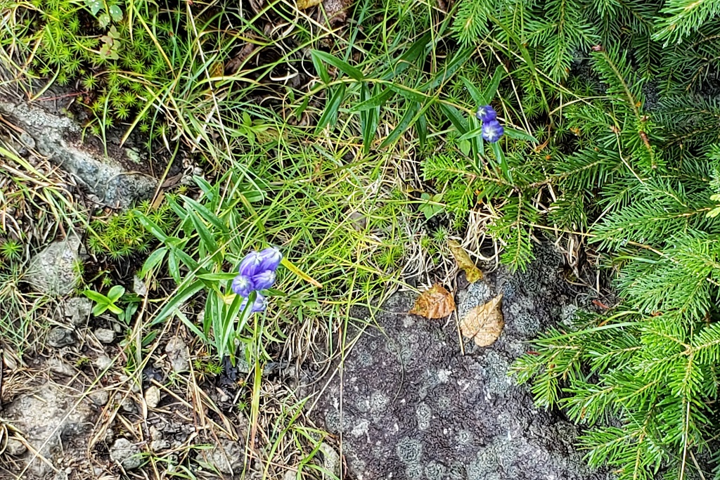
These flowers were growing right near the base of the slide, I've captured these growing in creek beds as well.
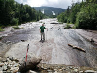
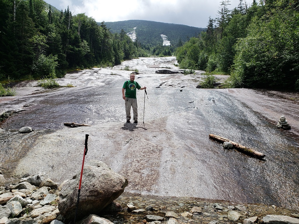
Brian at the base of the slide with a view behind of just how far we have yet to go up! The picture doesn't do the steepness of the slide justice. There was also water running down it so navigating it even for the short section that we needed was tricky.
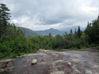
A couple more full views of the slide, the shoulder of the mountain above us, was just that, a shoulder. There was another .4 miles of climb after that.
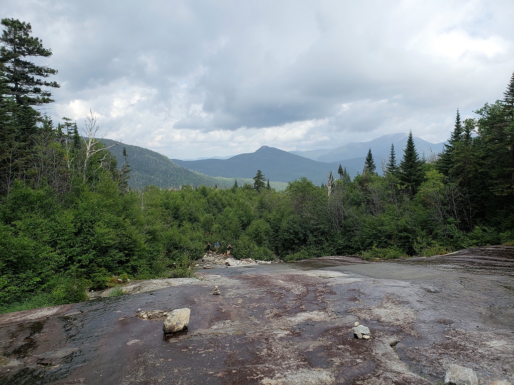
Looking back on the slide just before entering the trail again, we get a nice view of Noonmark and Giant.
After the slide, the trail gets very steep and rugged. I recalled how steep in our conversations up to this point but was still amazed at how rugged it was. The ascent to the junction of the Hunters Pass trail is brutally steep, then you turn left and head toward the knife edged peak that is Dix's summit. That climb is almost as steep and maybe more rugged as the boulders are bigger.
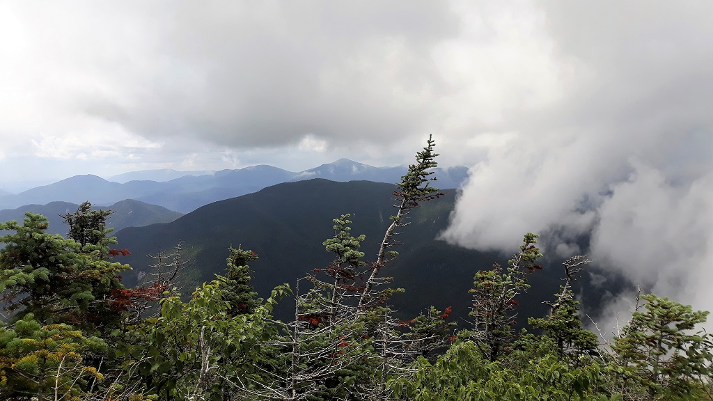
Matt got this view looking back from the final push on the shoulder of the summit. Nice!
 Click the thumbnail for a short video Brian took of me cresting the
summit ridge.
Click the thumbnail for a short video Brian took of me cresting the
summit ridge.
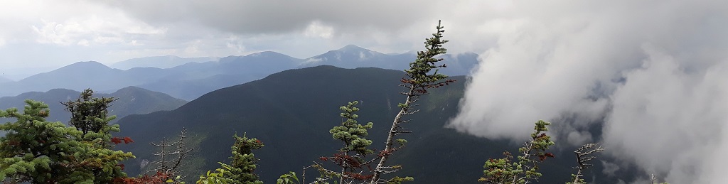
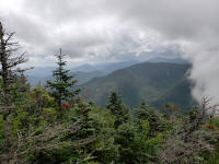
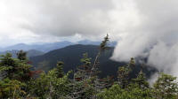
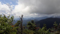
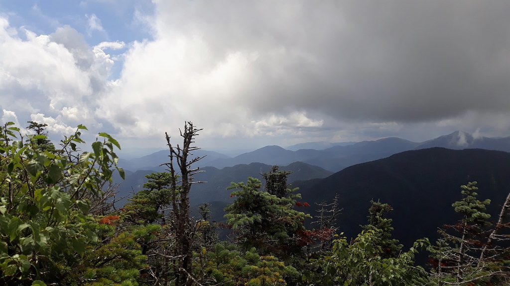
The views did not disappoint either.
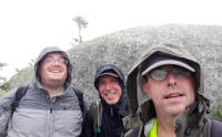
Brian taps the summit marker and records #46. Congrats buddy!

So, Brian completed his quest. We congratulated and toasted him. All the while looking over our shoulders at the ominous sky that was approaching from the southwest. We were already getting socked in to the north, but the cloud was actually below us. It was eerie and very cool at the same time. There were distant rumbles of thunder as well which made us expedite our celebration a little. Matt brought a 46er patch and presented it to Brian, which was very cool. Yeah I took lots of pictures here as well. Just about the time we thought we should start heading down, the clouds both ascended and descended upon us. The temperature dropped at least 20 degrees, the wind started howling and it started raining sideways. We quickly put on our rain gear ...... this is where I should have put my phone in a plastic bag or at least my rain jacket pocket, but I was so focused on losing some elevation before the storm really hammered the peak that I didn't think about it and just left it in my shorts pocket to drown :(
 Still on the summit just before the storm unleashed on us.
PUBLIC SERVICE ANNOUNCEMENT: When they say that the conditions can change quickly in the mountains so be prepared, they are not kidding. Of course I know this and we were prepared but this was the most drastic change I've experienced while hiking in the high peaks.
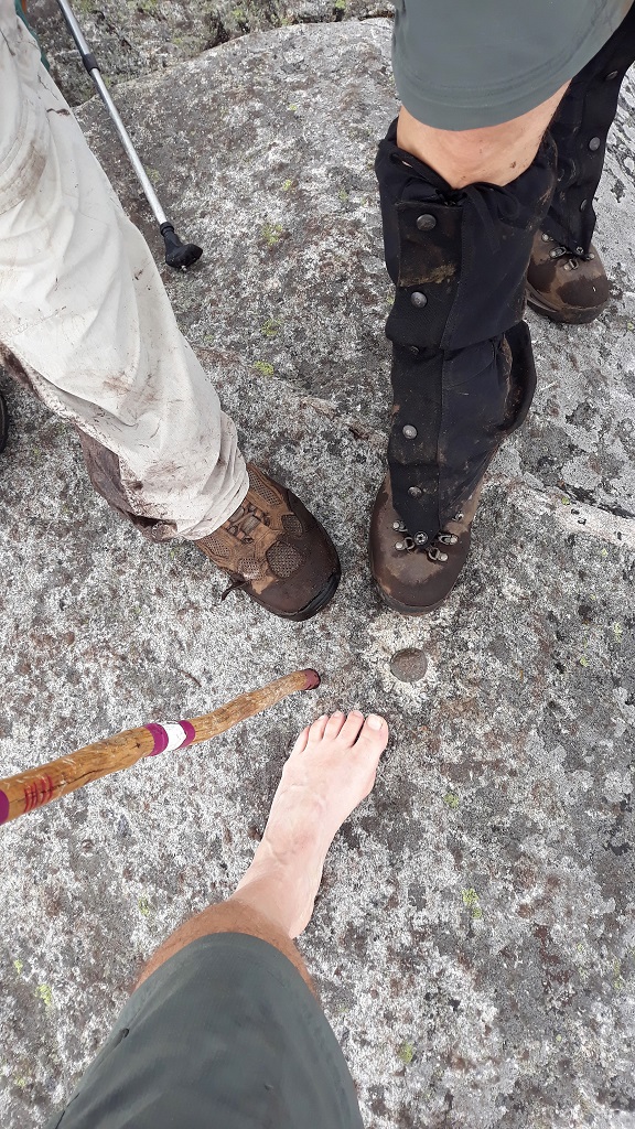
We started down the mountain right away and even though I had on a rain shell it seemed to not do much after a while. I actually started feeling a little cold so I decided to pick up the pace and get lower until I could find shelter to change my shirt etc... I left my partners behind in hopes of meeting them at the lean-to. That hike down was wild, I can honestly say that I would not have been any wetter had I jumped in a pool with all my gear. It was raining that hard. Of course like many thunderstorms it only lasted about an hour at the most and before we knew it the sun was shining again. I was at the lean-to by this time and realizing that my phone had drowned. I tried to shut it off but the damage was done. I was so aggravated with myself that I decided to book it out the rest of the way to the trailhead. I also wanted to get out of my wet boots and socks as quick as possible.
So, none of my pictures or videos survived. I feel bad because I took some of Brian on the summit.
Brian and Matt took their time getting down and out, the trail was pretty treacherous in spots during and after the storm. I made it to the trailhead a full 2 hours and 15 minutes ahead of them. They came out in the dark.
It's official!

This trip would prove to be a memorable adventure for a few reasons. To start, I was accompanying Brian on his final peak to complete his 46er quest. Brian has joined me on a good many hikes, especially early in both of our hiking careers. We were also joined this day by Matt who is a friend of Brian's who had already achieved his 46er status in 2016.
We met at the Round Pond trailhead around 8:30 and were on our way by 8:45. There was no urgency to start early, the days are still long right? The weather was very nice to start, while it was fairly warm and muggy, there were surprisingly very few bugs and no rain (yet).

It wouldn't be long before we had skirted around Round Pond and were well on our way to the junction with the Noonmark trail. We were passed by a group of probably 10 or more young hikers going to Noonmark. We would pass them taking a break at the junction prior to heading toward the summit.
Shortly after here, it began to rain but we were sheltered by the canopy so we only felt enough water to give us a break from the heat, it was actually quite welcoming. It didn't last however. The trail is fairly wide and easy to travel on with few exceptions such as large boulders.

We noticed some interesting flora growing under the canopy in the wet leaves. I believe these are called Indian Pipe Fungus, it's actually not a true fungus however. Google it!
Once again we saw some of these interesting patterns on rocks, I've seen them many times before in the "dacks, not sure if it's moss or some sort of fossil.
 Check out the one we saw last fall near Lake Tear of the Clouds -
here
Check out the one we saw last fall near Lake Tear of the Clouds -
here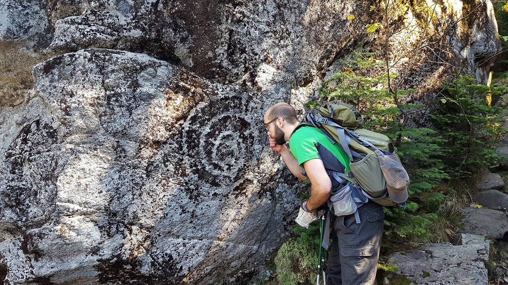
Of course we saw many toads and a few salamanders as well. I took many pictures of the trail and surrounding nature as well as my hiking partners along the way. Of course none of them exist anymore, we'll get to that. I'm glad Brian and Matt took some pics on the trip.
The trail follows the Bouquet River for quite a while. It's always been very enjoyable to me to hike alongside a creek or brook, both from a visual perspective and just to hear the running water. There are many nice clear pools and small waterfalls along the way as well.
 Here I am taking some pictures of just such a clear pool.
We arrived at the old lean-to site in time for lunch. We would also fill up on water here in the Bouquet. From here the trail starts to get moderately steep, but the real work would begin once we arrived at the base of the large slide. Just prior to the slide, the trail is literally right in the creek bed.
 A very interesting boulder that looks like it was split with a
cleaver.
A very interesting boulder that looks like it was split with a
cleaver. Standing in the trail / creek just prior to entering the clearing at
the base of the slide.
Standing in the trail / creek just prior to entering the clearing at
the base of the slide.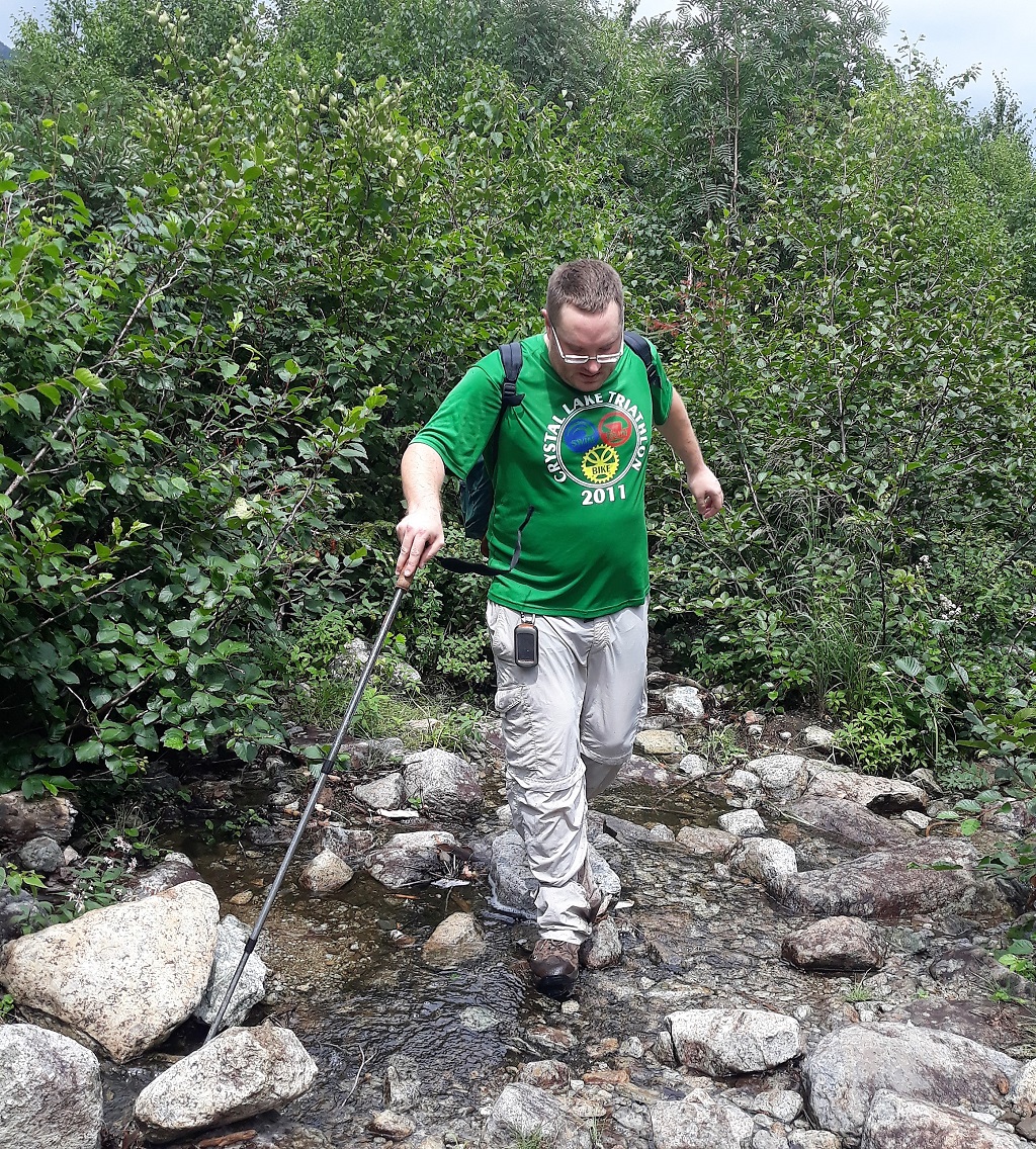 Here's Matt entering the clearing and about to be amazed at what's
before him.
Here's Matt entering the clearing and about to be amazed at what's
before him.These flowers were growing right near the base of the slide, I've captured these growing in creek beds as well.
Brian at the base of the slide with a view behind of just how far we have yet to go up! The picture doesn't do the steepness of the slide justice. There was also water running down it so navigating it even for the short section that we needed was tricky.
A couple more full views of the slide, the shoulder of the mountain above us, was just that, a shoulder. There was another .4 miles of climb after that.
Looking back on the slide just before entering the trail again, we get a nice view of Noonmark and Giant.
After the slide, the trail gets very steep and rugged. I recalled how steep in our conversations up to this point but was still amazed at how rugged it was. The ascent to the junction of the Hunters Pass trail is brutally steep, then you turn left and head toward the knife edged peak that is Dix's summit. That climb is almost as steep and maybe more rugged as the boulders are bigger.
Matt got this view looking back from the final push on the shoulder of the summit. Nice!
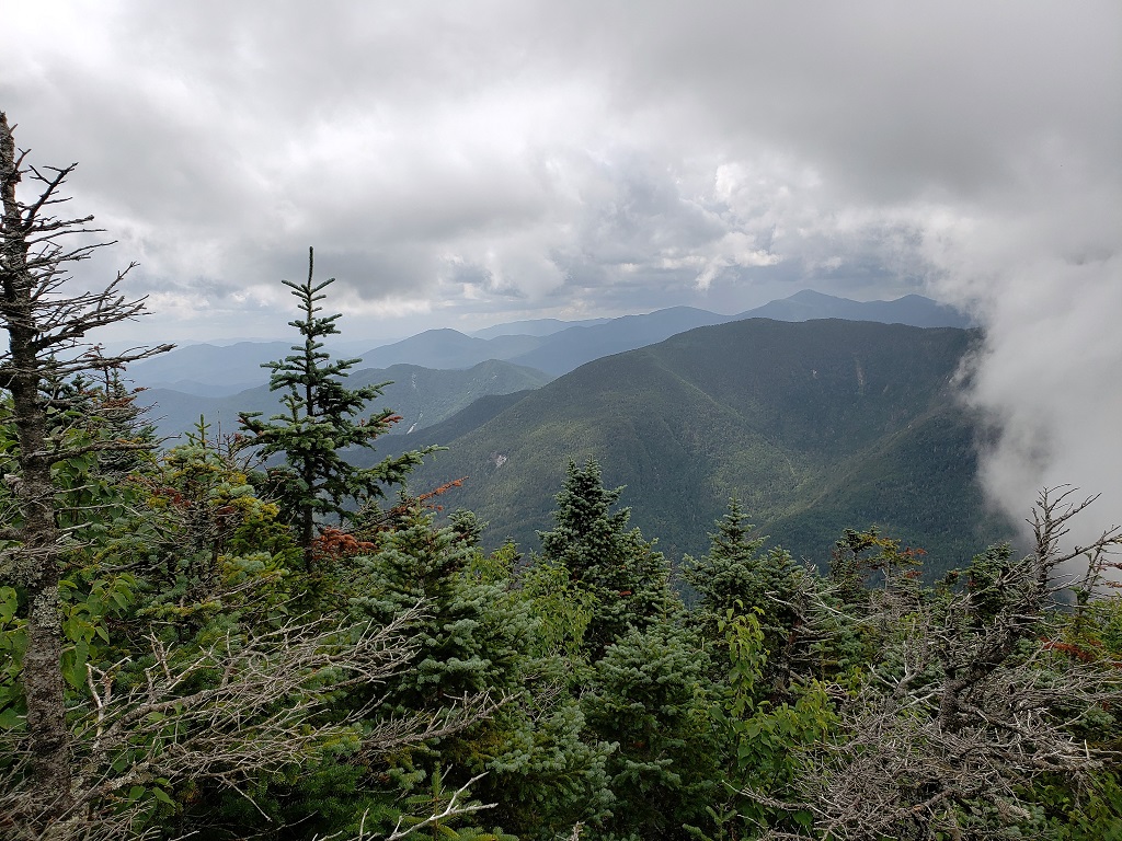
The views did not disappoint either.
Brian taps the summit marker and records #46. Congrats buddy!
So, Brian completed his quest. We congratulated and toasted him. All the while looking over our shoulders at the ominous sky that was approaching from the southwest. We were already getting socked in to the north, but the cloud was actually below us. It was eerie and very cool at the same time. There were distant rumbles of thunder as well which made us expedite our celebration a little. Matt brought a 46er patch and presented it to Brian, which was very cool. Yeah I took lots of pictures here as well. Just about the time we thought we should start heading down, the clouds both ascended and descended upon us. The temperature dropped at least 20 degrees, the wind started howling and it started raining sideways. We quickly put on our rain gear ...... this is where I should have put my phone in a plastic bag or at least my rain jacket pocket, but I was so focused on losing some elevation before the storm really hammered the peak that I didn't think about it and just left it in my shorts pocket to drown :(
 Still on the summit just before the storm unleashed on us.
PUBLIC SERVICE ANNOUNCEMENT: When they say that the conditions can change quickly in the mountains so be prepared, they are not kidding. Of course I know this and we were prepared but this was the most drastic change I've experienced while hiking in the high peaks.
We started down the mountain right away and even though I had on a rain shell it seemed to not do much after a while. I actually started feeling a little cold so I decided to pick up the pace and get lower until I could find shelter to change my shirt etc... I left my partners behind in hopes of meeting them at the lean-to. That hike down was wild, I can honestly say that I would not have been any wetter had I jumped in a pool with all my gear. It was raining that hard. Of course like many thunderstorms it only lasted about an hour at the most and before we knew it the sun was shining again. I was at the lean-to by this time and realizing that my phone had drowned. I tried to shut it off but the damage was done. I was so aggravated with myself that I decided to book it out the rest of the way to the trailhead. I also wanted to get out of my wet boots and socks as quick as possible.
So, none of my pictures or videos survived. I feel bad because I took some of Brian on the summit.
Brian and Matt took their time getting down and out, the trail was pretty treacherous in spots during and after the storm. I made it to the trailhead a full 2 hours and 15 minutes ahead of them. They came out in the dark.
It's official!
Back to Top